GPS in low Earth orbit and the signal trick
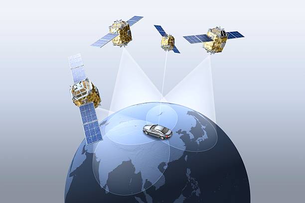
First, understand the problem. GPS satellites orbit at around 20,200 kilometers above Earth, in Medium Earth Orbit (MEO). Their signals are designed to reach the surface, not to punch upward into space. When a LEO satellite—say a Starlink node or a science bird like the ISS—tries to receive GPS, it’s sitting 400 kilometers above the surface. The signals come in at a shallow angle, passing through the ionosphere and atmosphere, which bends and weakens them. Worse, the LEO satellite is moving so fast that the Doppler shift makes the signal frequency wobble like a warped record. Standard GPS receivers meant for cars or phones just give up.
The trick is to flip the antenna upside down. No joke. Most commercial GPS antennas are designed to see upward, toward the sky. For a LEO satellite, that’s wrong. The strongest GPS signals arrive from the opposite side of the Earth, below the satellite’s horizon. Engineers mount the antenna so it points away from Earth, toward the limb of the planet. That lets the receiver catch the faint signals skimming the atmosphere. It’s counterintuitive—point your GPS antenna away from where you think the satellites are—but it works.
But that’s only half the story. The actual trick goes deeper. LEO satellites use a technique called “GPS occultation” or “radio occultation.” Instead of treating the GPS signal as a simple position fix, the satellite exploits the signal’s journey through the atmosphere. As the GPS waves bend through different layers of air, they change speed and frequency. A sophisticated receiver on the LEO satellite measures these distortions. By analyzing how the signal warps, the satellite can calculate its own orbit with centimeter-level precision, even when the direct line-of-sight to the GPS satellite is blocked. This is the same principle used to study weather patterns and atmospheric density. For navigation, it means the satellite doesn’t need a clean signal—it just needs a distorted one.
The real engineering marvel is the “GPS receiver on a chip” that can handle radical Doppler shifts. A typical GPS receiver expects signals to shift by a few kilohertz as you drive down the highway. A LEO satellite’s receiver must handle shifts of tens of kilohertz, plus signal power that fluctuates by orders of magnitude as the satellite spins or passes into Earth’s shadow. The trick is in the software-defined radio architecture. Instead of hardwired circuits, these receivers use fast analog-to-digital converters and field-programmable gate arrays (FPGAs) to dynamically adjust the search window. They literally guess where the signal will be a thousand times per second, then lock onto it the moment it appears.
This matters because LEO satellites don’t carry atomic clocks. GPS works because your receiver compares signal arrival times from multiple satellites. Without an accurate clock on board, a LEO satellite would need to ping a ground station constantly. That’s expensive and introduces latency. Using the GPS trick, the satellite can solve for both position and clock error in real time, using the same math your phone uses but scaled for orbital dynamics.
For the future of space travel, this technology is critical. Constellations like SpaceX’s Starlink, Amazon’s Project Kuiper, and OneWeb rely on precise autonomous navigation to avoid collisions and maintain formation. They can’t afford to wait for ground control to say “turn left.” The GPS signal trick lets each satellite figure out exactly where it is, every second, without human input. It also opens the door for autonomous orbital rendezvous and docking. When Starship or other crewed vehicles need to link up with a fuel depot or another spacecraft, they’ll use these same principles. The signal trick turns the whole Earth’s atmosphere into a lens, not a barrier.
So next time you fire up Google Maps, remember: the same GPS network that gets you to Taco Bell is also guiding thousands of machines in low Earth orbit. And they do it by ignoring the obvious, pointing their antennas backwards, and reading the distortions in the signal. That’s the difference between a gadget and a spacecraft.
Space News
Latest Articles
New rockets, upcoming launches, and the stories shaping humanity's push off this planet. No astronomy degree required.