Optical navigation and the crater recognition software
Here is how it works, why it matters, and why you should care about it even if you never plan to leave the couch.
The Problem: Space Is Dark and Full of Rocks
When a lander approaches a planetary surface, it is moving at thousands of miles per hour. The ground below is not flat. It is a mess of shadows, ridges, boulders, and craters of every size. Inertial measurement units—basically gyroscopes and accelerometers—tell the spacecraft which way is up and how hard it is accelerating, but they drift over time. A tiny error in orientation during a high-speed descent becomes a mile-long miss when you hit the ground. You cannot look up coordinates on your phone. There is no satellite constellation beaming down position data. There is only the surface itself, and you have to read it like a map you have never seen before.
Early missions handled this with radar altimeters and pre-loaded terrain models. That worked for big, flat landing zones. But for precision landings near scientifically interesting features—like a crater rim or a lava tube entrance—radar alone is not enough. You need to know not just how high you are, but exactly where you are relative to the rocks below.
The Solution: Eyes and a Memory
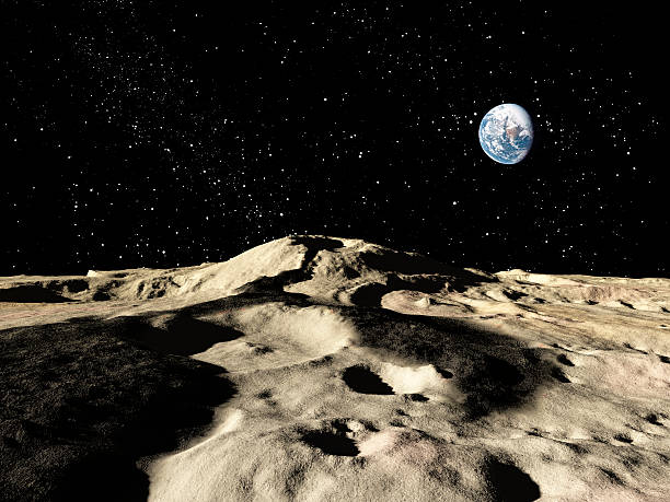
Optical navigation solves this by giving the spacecraft a camera that takes rapid pictures of the ground as it descends. The software inside compares those live images against a stored database of known surface features. Crater recognition software is the most robust version of this because craters are everywhere and they are geometrically stable. A crater does not change shape over months or years. It does not grow plants or get covered by snow. It is a permanent, recognizable landmark.
The software looks at the shadows inside a crater, the rim shape, the diameter, and the spacing between nearby craters. It triangulates the spacecraft’s position relative to those features in real time. If the onboard map says three craters of specific sizes should be arranged in a triangle, and the camera sees them exactly that way but slightly offset, the computer knows exactly how much it needs to correct its trajectory. This happens multiple times per second, with each correction getting finer as the ground gets closer.
Why Crater Recognition Beats Everything Else
Some engineers have experimented with optical flow—tracking how features move between frames to estimate velocity—and with LIDAR-based terrain mapping. Both have their place, but crater recognition is the gold standard for landing on airless bodies like the Moon or small rocky planets. LIDAR requires active laser beams and burns power. Optical flow drifts if the surface texture is uniform. Craters, however, are everywhere on the Moon and Mars. They are natural landmarks that do not require artificial beacons or complex hardware. The software just needs a good reference map and enough processing power to compare images quickly.
Modern landers carry pre-loaded global maps built from orbital imagery. The Mars 2020 Perseverance rover used this kind of system to land inside Jezero Crater, a delta formation that would have been suicidal to aim for with older technology. The lander saw the crater rim, matched it to its memory, and steered itself into the safe zone with no human input. That is the difference between a mission that makes headlines and a mission that makes a new impact crater.
The Black Box Connection
This is where the “black box” part of the website section comes in. The crater recognition software itself is a black box in the engineering sense. You feed it images, and it gives back a position estimate. The decisions inside—how it weighs shadow angles versus rim curvature, how it filters out false matches, how it handles dust kicked up by the landing thrusters—are complex algorithms that most operators never touch directly. But the entire guidance system depends on that black box working right the first time. There is no patch for a landing software bug. If the recognition software fails to find a match, the spacecraft either falls back to inertial guidance or plows into the ground blind.
That is why test runs on Earth use simulated crater fields and high-altitude drop tests. The software must be battle-hardened before it ever leaves the launch pad.
The Future Is Crater-Literate
As NASA, SpaceX, and international space agencies push for permanent bases on the Moon and crewed missions to Mars, optical navigation will only get more important. You cannot land a Starship next to a pre-built habitat by guessing where you are. You need centimeter-level accuracy, and you need it in real time. Crater recognition software is evolving to use machine learning, which can identify craters even when they are partially shadowed or degraded. The next generation of landers will carry databases of not just craters but also boulders, ridges, and human-made structures like landing pads.
When the first boots step onto the Moon again, the computer that gets them there safe will not be following a radio signal from Earth. It will be looking at the ground, reading the craters, and knowing exactly where it belongs.
---
Space News
Latest Articles
New rockets, upcoming launches, and the stories shaping humanity's push off this planet. No astronomy degree required.